Log in
All resources
Create a design
514 Free Artworks of Index (publishing)
maps in the library of congress
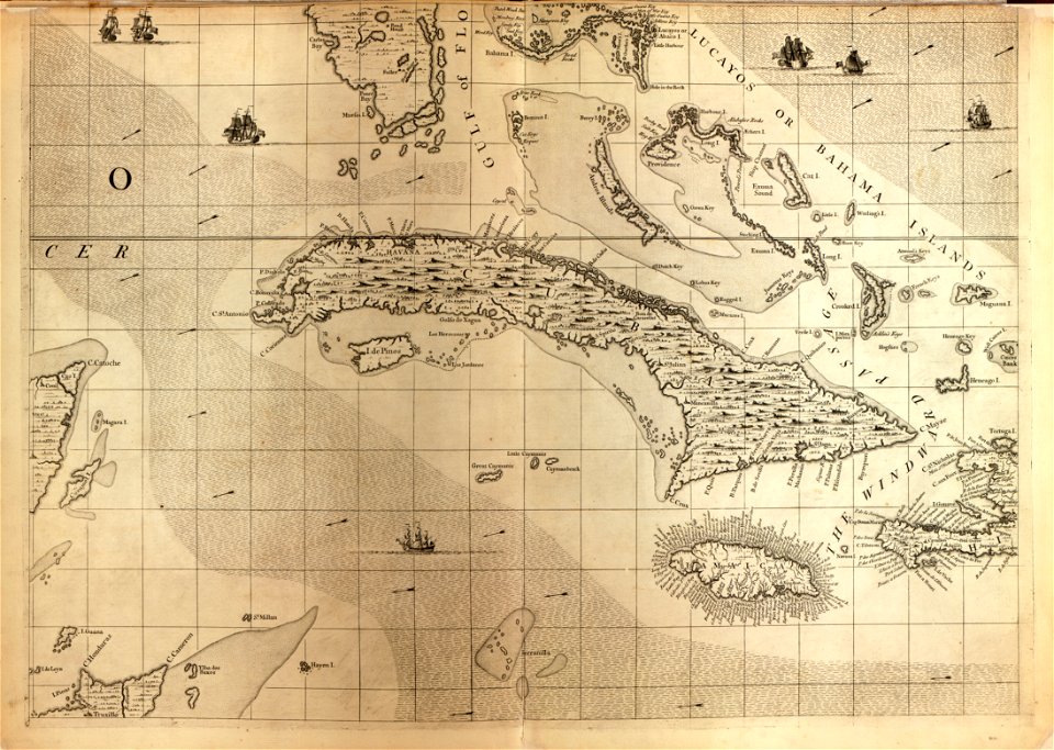
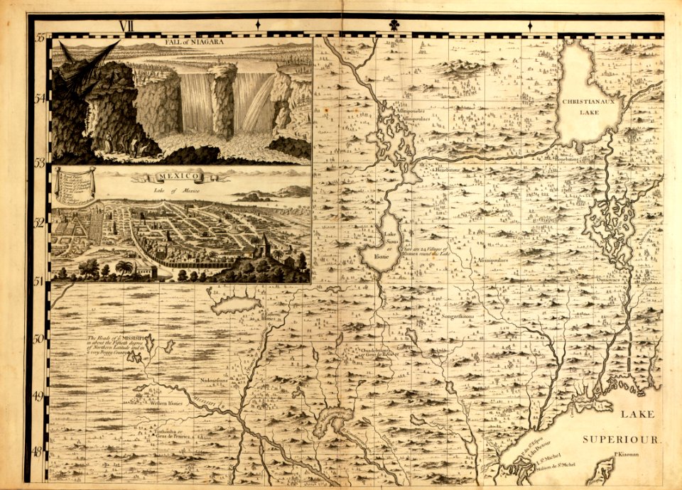
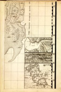
a map of the british empire in america with the french and spanish settlements adjacent thereto
civitates orbis terrarum. urbium praecipuarum totius mundi. liber quartus
drawing
digital library of university of wroclaw
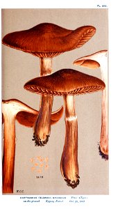
mordecai cubitt cooke
illustrations of british fungi vol. vi
paul marny
portraits of william lionel wyllie
william lionel wyllie
a map of the british empire in america with the french and spanish settlements adjacent thereto
maps in the library of congress
paul marny
portraits of william lionel wyllie
william lionel wyllie
paul marny
portraits of ralph hedley
realism
thomas holroyd
thomas ralph spence
portraits of william lionel wyllie
william lionel wyllie
ralph hedley
realism
paul marny
paul marny
paul marny
portraits of william lionel wyllie
william lionel wyllie
paul marny
portraits of william lionel wyllie
william lionel wyllie
thomas ralph spence
paul marny
djvu files in english
rococo
colonial history of the united states
old maps of new york (state)
ogura nazorae hyakunin isshu
ukiyo-e
frank leslie's illustrated newspaper, 1861
american civil war in 1861
the war in egypt and the soudan (1886)
herbert stewart (general)
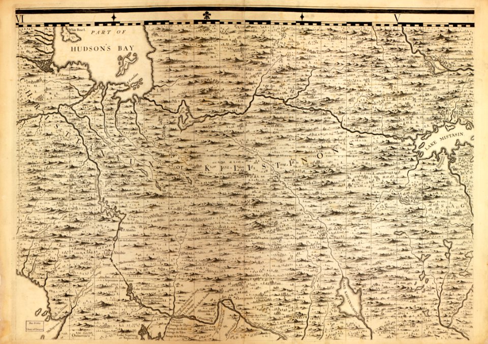
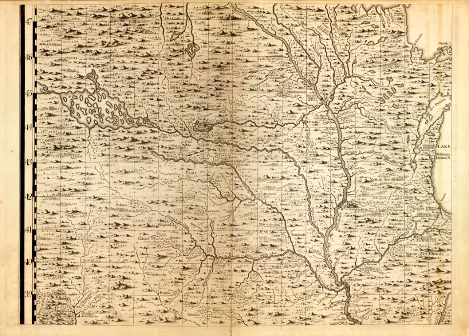
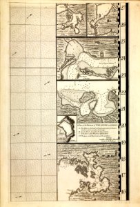
a map of the british empire in america with the french and spanish settlements adjacent thereto
maps in the library of congress
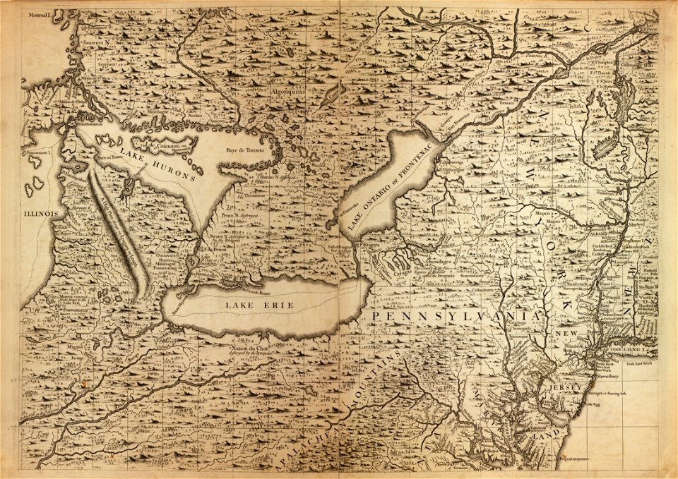
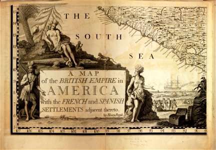
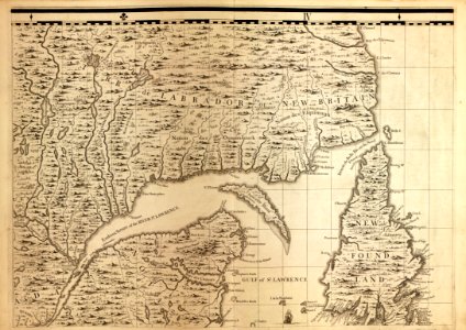
a map of the british empire in america with the french and spanish settlements adjacent thereto
maps in the library of congress
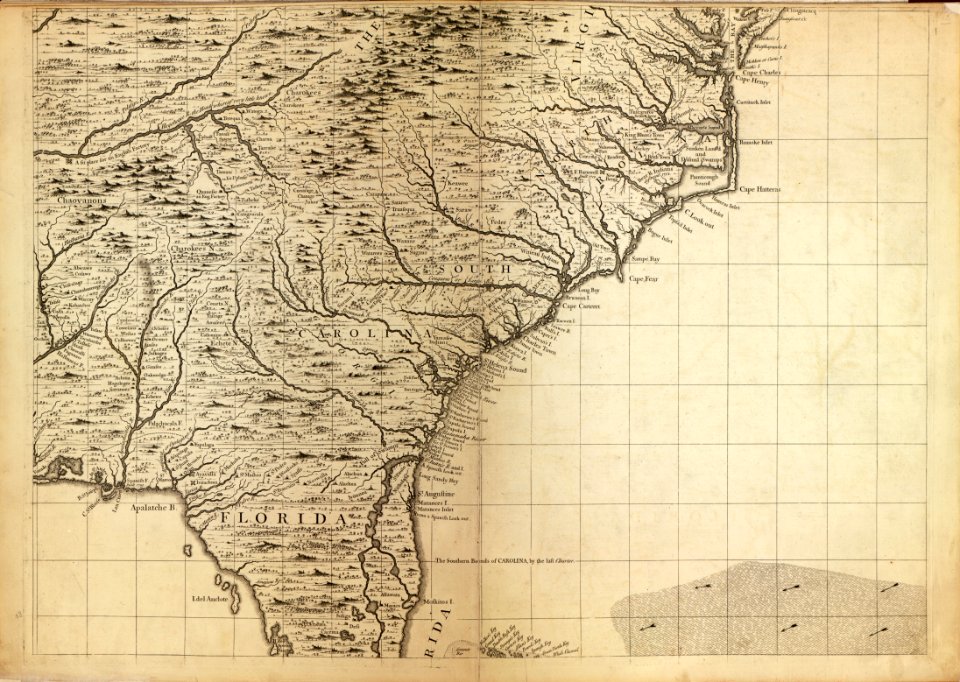
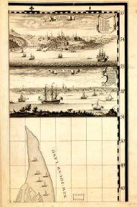
a map of the british empire in america with the french and spanish settlements adjacent thereto
maps in the library of congress
a map of the british empire in america with the french and spanish settlements adjacent thereto
maps in the library of congress
a map of the british empire in america with the french and spanish settlements adjacent thereto
maps in the library of congress
a map of the british empire in america with the french and spanish settlements adjacent thereto
maps in the library of congress
a map of the british empire in america with the french and spanish settlements adjacent thereto
maps in the library of congress
a map of the british empire in america with the french and spanish settlements adjacent thereto
maps in the library of congress
a map of the british empire in america with the french and spanish settlements adjacent thereto
maps in the library of congress
a map of the british empire in america with the french and spanish settlements adjacent thereto
maps in the library of congress
a map of the british empire in america with the french and spanish settlements adjacent thereto
maps in the library of congress
a map of the british empire in america with the french and spanish settlements adjacent thereto
maps in the library of congress
a map of the british empire in america with the french and spanish settlements adjacent thereto
maps in the library of congress
a map of the british empire in america with the french and spanish settlements adjacent thereto
maps in the library of congress
a map of the british empire in america with the french and spanish settlements adjacent thereto
maps in the library of congress
a map of the british empire in america with the french and spanish settlements adjacent thereto
maps in the library of congress
18th-century maps of kent
maps by thomas kitchin
maps in the library of congress
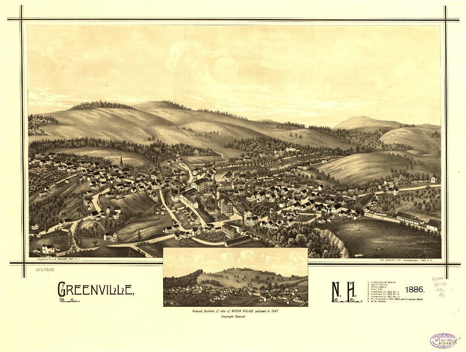
1886 maps of new hampshire
postcards published by jean geiser
historical photographs of algiers
w.t. pike contemporary biographies (london), illustrations
grove road power station
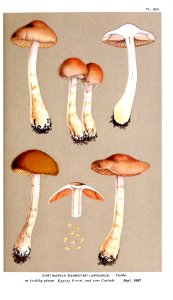
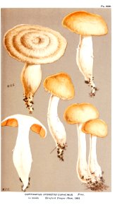
illustrations of british fungi vol. vi
cortinarius callisteus
illustrations of british fungi vol. vii
russula delica
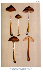
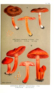
illustrations of british fungi vol. vi
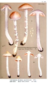
cortinarius anomalus
the holy bible according to the authorized version: with notes, explanatory and practical; taken principally from the most eminent writers of the united church of england and ireland, together with appropriate introductions, tables, indexes, and m. (1896)
black obelisk
tatoe-gusa oshie hayabiki (instructive index of all sorts of proverbs) by utagawa kuniyoshi
ukiyo-e
maps by bernard ratzer
maps by thomas kitchin
cortinarius disjungendus
cortinarius brunneus
illustrations of british fungi vol. vi
cortinarius anomalus
illustrations of british fungi vol. vi
cortinarius casimiri
illustrations of british fungi vol. vi
cortinarius gentilis
illustrations of british fungi vol. vi
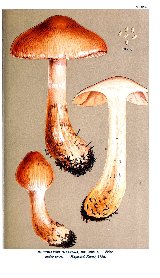
cortinarius brunneus
illustrations of british fungi vol. vi
cortinarius brunneus
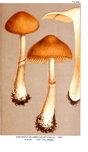
illustrations of british fungi vol. vi
cortinarius armillatus
illustrations of british fungi vol. vi
cortinarius rigens
illustrations of british fungi vol. vi
cortinarius anomalus
illustrations of british fungi vol. vi
cortinarius disjungendus
illustrations of british fungi vol. vi
cortinarius cagei
rare books and manuscripts in the usc digital library
nihonga
w.t. pike contemporary biographies (london), illustrations
the british hospital, istanbul
civitates orbis terrarum. urbium praecipuarum totius mundi. liber quartus
maps of malmö by braun & hogenberg
civitates orbis terrarum. urbium praecipuarum totius mundi. liber quartus
maps of lund by braun & hogenberg
w.t. pike contemporary biographies (london), illustrations
broad street place
w.t. pike contemporary biographies (london), illustrations
broad street place
postcards in the getty research institute
20th-century photographs of algiers
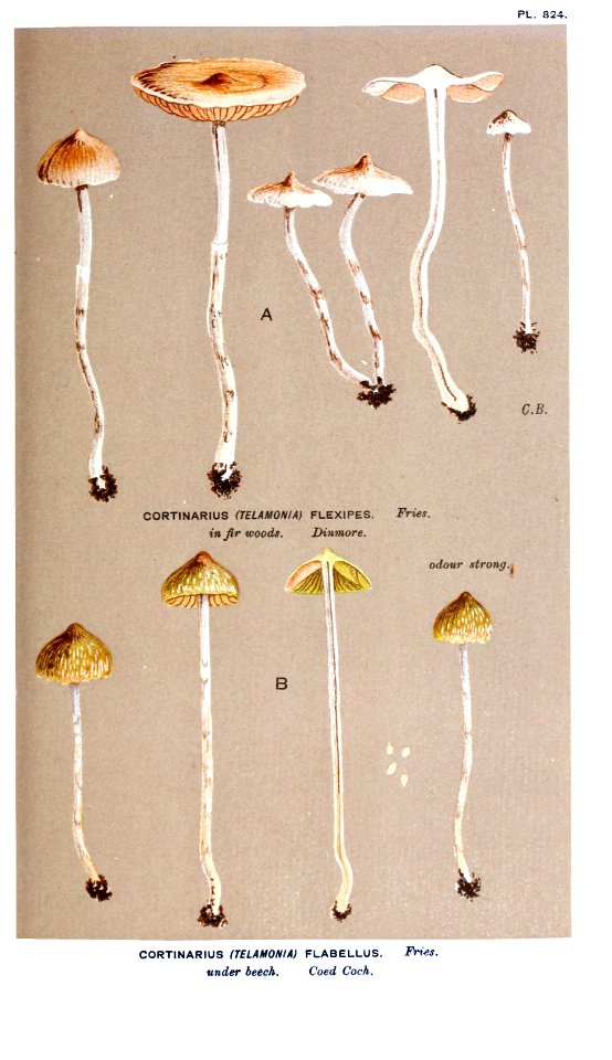
illustrations of british fungi vol. vi
cortinarius flexipes
18th-century paintings of battles
battle of khotyn (1673)
cortinarius cinnabarinus
cortinarius purpureus
cortinarius ionophyllus
cortinarius quadricolor
old maps of łódź
kosmopolita
across the sub-arctics of canada (1898)
arthur heming
civitates orbis terrarum. urbium praecipuarum totius mundi. liber quartus
maps of sneek by braun & hogenberg
civitates orbis terrarum. urbium praecipuarum totius mundi. liber quartus
maps of ijlst by braun & hogenberg
civitates orbis terrarum. urbium praecipuarum totius mundi. liber quartus
maps of landskrona by braun & hogenberg
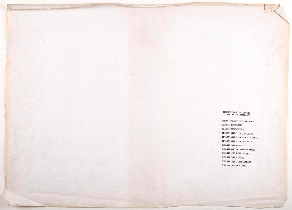
doings of death - william strang
1901 woodcuts
viaduc des rochers noirs
postcards of corrèze
across the sub-arctics of canada (1898)
rangifer tarandus (illustrations)
a map of the british empire in america with the french and spanish settlements adjacent thereto
maps in the library of congress
civitates orbis terrarum. urbium praecipuarum totius mundi. liber quartus
maps of sloten by braun & hogenberg
civitates orbis terrarum. urbium praecipuarum totius mundi. liber quartus
maps of harlingen by braun & hogenberg
civitates orbis terrarum. urbium praecipuarum totius mundi. liber quartus
maps of malmö by braun & hogenberg
woodcuts from japan in the los angeles county museum of art
utagawa toyonobu (歌川豊宣)
across the sub-arctics of canada (1898)
arthur heming
a map of the british empire in america with the french and spanish settlements adjacent thereto
maps in the library of congress
a map of the british empire in america with the french and spanish settlements adjacent thereto
maps in the library of congress
a map of the british empire in america with the french and spanish settlements adjacent thereto
maps in the library of congress
civitates orbis terrarum. urbium praecipuarum totius mundi. liber quartus
drawing
civitates orbis terrarum. urbium praecipuarum totius mundi. liber quartus
maps of arnsberg by braun & hogenberg
civitates orbis terrarum. urbium praecipuarum totius mundi. liber quartus
maps of serravalle by braun & hogenberg
civitates orbis terrarum. urbium praecipuarum totius mundi. liber quartus
drawing
civitates orbis terrarum. urbium praecipuarum totius mundi. liber quartus
drawing
civitates orbis terrarum. urbium praecipuarum totius mundi. liber quartus
drawing
civitates orbis terrarum. urbium praecipuarum totius mundi. liber quartus
maps of schleswig by braun & hogenberg
civitates orbis terrarum. urbium praecipuarum totius mundi. liber quartus
drawing
civitates orbis terrarum. urbium praecipuarum totius mundi. liber quartus
drawing
civitates orbis terrarum. urbium praecipuarum totius mundi. liber quartus
drawing
civitates orbis terrarum. urbium praecipuarum totius mundi. liber quartus
drawing
civitates orbis terrarum. urbium praecipuarum totius mundi. liber quartus
drawing
civitates orbis terrarum. urbium praecipuarum totius mundi. liber quartus
maps of bratislava by braun & hogenberg
101 - 200 of 514
Next page
/ 6